Sizewell C Flooding and Erosion Update- April 2024
Sizewell C Flooding and Erosion Update- April 2024
TASC has raised concerns with East Suffolk Council [in relation to their consideration of Sizewell C’s sea defences for their discharge of DCO Requirements] and the Office for Nuclear Regulation [in relation to their review of the site safety case for their External Hazards Assessment for Nuclear Site Licence purposes] about the lack of suitably precautionary assessments of the coastal geomorphology for the Greater Sizewell Bay and the impact this has on the flood risk assessments undertaken by the developer for the Sizewell C project. Our concerns endorse the work of local engineer Nick Scarr and a copy of his report on this subject is here [link]
………………………………………………………………………………………………………………………………………………………………………………………………….
During the Sizewell C DCO examination, TASC drew the Planning Inspectorate’s (PINS) attention to our concerns about the vulnerability of the Sizewell C site to flooding due to: rising sea levels, increased storm surges and more extreme weather events resulting from climate change; the fact that EDF’s flood modelling has only been taken up to 2140 when highly radioactive spent nuclear fuel will be still stored on site for decades beyond 2140; and EDF’s geomorphological assessment of the coast in and around the Sizewell area was not completed on a sufficiently conservative basis.
Our last report was submitted at ‘Deadline 10‘ ie right at the end of the DCO examination process. Unfortunately, PINS and the Secretary of State ignored our concerns and similar ones submitted by numerous other Interested Parties (IPs) involved in the DCO process.
One of the IPs with a great interest in coastal geomorphology issues is local engineer Nick Scarr who submitted various reports during the Sizewell C examination and who has continued to press the government and statutory regulators on the failure of EDF and the statutory authorities to adequately assess the threat of flooding and erosion to the Sizewell C site. His latest 3 reports can be accessed here.
The potential implications of building Sizewell C in a Suffolk flood plain
Nick Scarr 22.11.22
Rev.9 How the Regulation of the Sizewell C DCO process may have failed future generations. Nick Scarr 22.11.22
Sizewell C’s EGA- The Applicant’s non-precautionary shoreline change assessment for the Greater Sizewell Bay. Nick Scarr 08 9 2022
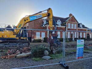
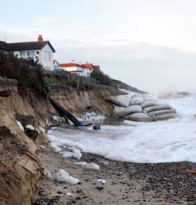
A recent event that highlights the vulnerability of the coast in the Sizewell area was the subject of a TASC Press Release that related to the demolition of the Red House in Thorpeness due coastal erosion.


The map above reproduced from Climate Central shows the flood risk around the Sizewell plants at 1.2 mtrs
In 2009 scientists warned that rising sea levels, triggered by global warming, pose a far greater danger to the planet than was previously estimated. There is now a major risk that many coastal areas around the world will be inundated by the end of the century because Antarctic and Greenland ice sheets are melting faster than previously estimated.1
According to a report by the Centre for Environmental Policy at the Imperial College London, the rising sea levels could lead to extensive flooding around the coast of East Anglia. Storm surge heights with a 50 year return interval are predicted to reach heights of over 410cm OD by the end of the 21st century, and it is likely that 100 year return period events will occur every 20 years by 2050.2
Coastal Erosion
The coastline around Sizewell is very dynamic and it is difficult to precisely predict its future behaviour. It is known that vast volumes of deposits, such as those that make up the coast at Sizewell, can be moved in a single storm surge. For example, it was estimated that 30.000m3 of material was moved at the Scott Head when the dunes were cut back by 20m during the 1978 storm surge.3
According to Dr Colin Brown, director of engineering at the Institution of Mechanical Engineering:
“…Sizewell will certainly be affected by rising sea levels. Engineers say they can build concrete walls that will keep out the water throughout the working lives of these new plants. But that is not enough. Nuclear plants may operate for 50 years, but it could take hundreds of years to decommission them. By that time, who knows what sea-level rises and what kinds of inundations the country will be experiencing?”4

Although it is noted in the Sizewell C stage 1 environmental report that coastal erosion is a problem and that extra sea defences will be necessary, there are no examples of how this might be achieved, or any assessment of the affects (social, economic and environmental) on the local area of Sizewell These possible affects need to be studied and quantified before any benefits of the power station can be weighed against the possible loss of homes, businesses and agricultural land as well as the natural environment including Minsmere and the Sizewell AONB. In mitigating any degradation of the shore defences at Sizewell there has been no data presented to show what effect these would have on the adjoining coastline either. Currently the erosion of areas to the north of Sizewell provides material which is naturally transported south along the coast to provide protection for both Sizewell and further south to Thorpeness. Any disruption to this natural process to provide protection for the power stations would necessarily decrease the protection to the south. It has been noted by several local residents that the Thorpeness area which has been relatively stable recently has undergone increased erosion, and increased sea defences have been put in place. EDF are apparently confident that the calculations, for the design for Sizewell C, will ensure it is sufficiently robust to withstand storm surge levels, therefore they should perhaps be able to also give some indication of the costs and consequences of various flood mitigation measures, given that they have had several years within which to study the coastline. It is difficult to have a meaningful consultation without first being given any sort of clue what we may be faced with at Sizewell.
In the 2008 Proposed Nuclear Development at Sizewell – Environmental Scoping Report, British Energy flood defences are described as follows
“The Sizewell frontage incorporates a soft shore flood defence. There are two lines of embankment (in general appearance, vegetated dunes) fronting the Sizewell C Site which, properly maintained, comprise the flood defences. The 10m high embankment fronting the B site has an internal structure but the 5m high embankment does not. The design concept is that the 5m structure will collapse into the beach and thus mitigate erosion influences on the 10m structure during extreme storm events.”5
It is unclear whether the 5m structure, once collapsed, would be built up again, or whether it is assumed that only one such extreme storm event will take place during the lifetime of radioactive material being stored at the site. If the 5m structure collapses then it will no longer be there to mitigate future erosion influences on the 10m structure.

The consultation documents published by EDF do not appear to contain any discussion of who might pay for the flood defences. If areas around Sizewell are allowed to be breached in order to lessen the impact of flooding at the Nuclear Power Stations themselves, it is unclear whether homes and businesses will be compensated for their loss by EDF, the government or insurance or whether they will be expected to cover the costs personally. If EDF have factored in a contingency for flood defences, then they should be able to give an indication of precisely what this will cover. If they have not made decisions on what will be paid for, it is difficult to assess how the government and EDF will reach the strike price for nuclear power which is set to be announced imminently.
3 The Storm Surge of 11 January 1978 on the East Coast of England, J.A. Steers, D. R. Stoddart, T. P. Bayliss-Smith, T. Spencer and P. M. Durbidge,The Geographical Journal, Vol. 145, No. 2 (Jul., 1979), pp. 192-205
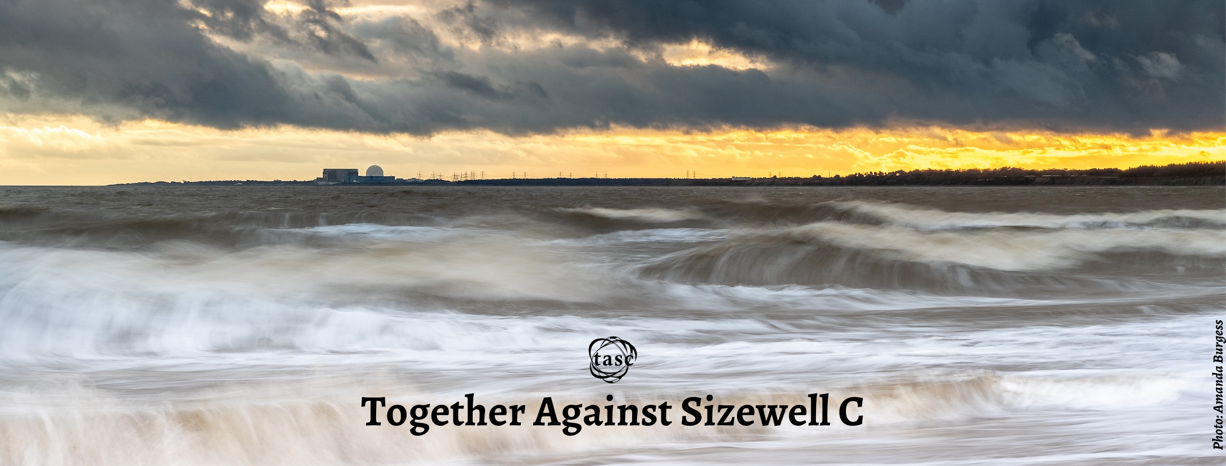
Featured image for this page by Fran Crowe – This information is also available in our leaflet.

